Singalila National Park
Singalila National Park
Straddling the India-Nepal border, Singalila National Park is the premier trekking destination in West Bengal. The ridge leads to Sandakphu, the highest point in the state, with views of four of the world's tallest summits.
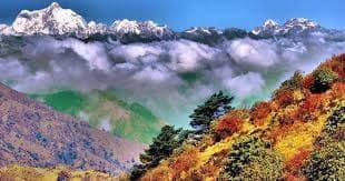
Singalila National Park stretches along the ridge border between India and Nepal, in Darjeeling district, West Bengal. Rising above 3,600 meters at its highest points, it offers some of the clearest views of Himalayan peaks from Indian soil, including Kangchenjunga and, on clear days, Everest. It is primarily a trekking park, traversed by the renowned Singalila Ridge Trek.
Quick facts
- Entry: fee-based — separate charges for Indian nationals and foreign visitors; Protected Area Permit required for foreign visitors (obtainable at Manebhanjan or Darjeeling).
- Access: main entry point at Manebhanjan, approximately 26 km from Darjeeling; accessible by shared jeep from Darjeeling.
- Best season: October–November (clear skies, faded rhododendrons but sharp views) and March–April (rhododendron blooms).
- Recommended duration: 4 to 5 days for a complete ridge traverse; possible in 2 days for a partial round trip to Tumling or Tonglu.
- What to wear: mountain trekking gear essential; very cold temperatures at night even in season.
- Accessibility: not suitable for persons with reduced mobility — high mountain terrain.
What to see
The park covers approximately 78 km² of rhododendron forests, bamboo, and alpine meadows. Wildlife includes the red panda — the park's emblem — musk deer, clouded leopard, and numerous Himalayan bird species. Vegetation changes dramatically with altitude: dense forests below, open moorlands on the ridge.
History and background
The area was designated a wildlife sanctuary in 1986, then elevated to national park status in 1992. The Singalila Ridge forms a natural border with Nepal; several villages along the trekking route, such as Tumling, straddle both countries. Local populations are predominantly of Nepali and Tibetan origin.
Highlights of your visit
The Singalila Ridge Trek
The classic route connects Manebhanjan to Phalut along the ridge. Each stage offers panoramas of Kangchenjunga (8,586 m), the world's third-highest peak. Village lodges provide accommodation; no wild camping is necessary.
Sandakphu (3,636 m)
The highest point in West Bengal, Sandakphu is the only place on Earth where you can simultaneously see the four tallest peaks on the planet: Everest, Kangchenjunga, Lhotse, and Makalu. Dawn is the crucial moment to visit.
Phalut (3,600 m)
The park's second-highest summit, Phalut offers an unobstructed view over the Nepali slopes and Kangchenjunga glaciers. Less crowded than Sandakphu, it rewards trekkers who extend their journey.
Rhododendron bloom
In March–April, forests between 2,500 and 3,500 meters blanket themselves in red, pink, and white rhododendrons. This is the most colorful season, though views of the peaks may be veiled by spring mist.
Photography tips
Dawn from Sandakphu is the decisive moment: snow-capped peaks capture pink light before sunrise. Arrive at the viewpoint 30 minutes before dawn. By day, mist rises quickly; best light is early morning and late afternoon. A telephoto lens is useful for isolating distant peaks.
Location and access
The park lies in Darjeeling district, on the India-Nepal border. Darjeeling is the natural logistical base, approximately 26 km from Manebhanjan by road. From Darjeeling, shared jeeps regularly serve Manebhanjan in the morning. The nearest airport is Bagdogra (code IXB), approximately 95 km from Darjeeling; trains connect New Jalpaiguri (NJP) to Darjeeling via the Toy Train or by jeep.
Nearby attractions
- Darjeeling — colonial hill station, famous for its tea plantations and the UNESCO-listed Darjeeling Himalayan Railway.
- Tiger Hill — viewpoint above Darjeeling, a classic vantage point for Kangchenjunga at dawn.
- Kalimpong — mountain town east of Darjeeling, known for its nurseries and Tibetan market.
Frequently asked questions
October and November offer the clearest skies and best views of the peaks. March–April is ideal for rhododendron blooms, but visibility may be reduced by mist. Avoid the monsoon (June–September): trails are slippery and views obscured.
Yes. Foreign visitors must obtain a Protected Area Permit, available at Manebhanjan or from Darjeeling authorities. Indian nationals pay park entry fees. Have your identity documents ready.
The ridge trail is well-marked and village lodges dot the route. A local guide is not mandatory but recommended for first-time visitors, particularly for permit management and high-altitude weather awareness.
Red pandas inhabit the park, but sightings remain difficult: the animal is nocturnal and elusive. Forested zones between 2,500 and 3,500 meters are most favorable. Observation is never guaranteed.
Waterproof hiking boots, warm layered clothing (nights drop below freezing even in October), rain jacket, trekking poles, and a first-aid kit. Lodges provide blankets and simple meals.
Yes, this is the standard itinerary. Most travelers spend 1 to 2 days in Darjeeling before heading to Manebhanjan for the trek. Darjeeling serves as a base for acclimatization and logistics.
Photos
Want to discover this destination?
Our local advisors design your tailor-made trip.